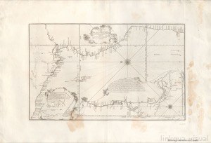
New and Correct Chart of the Pacific or South Sea constructed from the best information of its Pilots and the most accurate Astronomical and Nautical Observations in the year 1744
Artista: Fuente
Siglo XVII · América
Colección: Fuente
This map, titled "New and Correct Chart of the Pacific Sea or South Sea," is an example of Ibero-American historical cartography that documents the exploration and geographical knowledge of the region in the 18th century. Its style, characteristic of the era, focuses on coastal accuracy and representation.
textos-explicativos rosa-de-los-vientos mapa lineas-de-costa cuadricula-de-coordenadas albayalde papel-amate ceniza-de-volcan