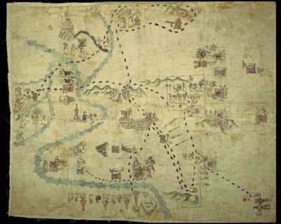
Map of Tenochtitlan and its surroundings
Artista: Mapas de Cuauhtinchan
Siglo XVI · México
Colección: Mapas de Cuauhtinchan
This pictorial map depicts the city of Tenochtitlan and its surroundings, with a winding river crossing the scene. Stylized buildings, human figures, and geographical elements like mountains are observed, all represented with a limited color palette and a detailed drawing style.
arquitectura asentamientos barro-de-oaxaca caminos-de-huellas cartografia cobre-de-chuquicamata codice dibujo