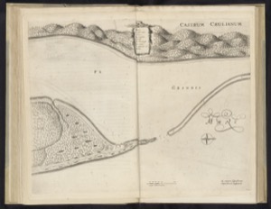
Old map of a port and coastal fortification
Artista: Cartógrafo anónimo (siglo XVII)
Siglo XVII · España
Colección: Cartógrafo anónimo (siglo XVII)
Anonymous 17th-century map of a fortified port. The aerial view details the maritime and terrestrial landscape, with a mountain range in the background and the sea entering the coast.
arena-de-veracruz ceniza-de-volcan costa fortaleza geografia grabado humo-de-paramo mapa