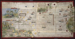
Images atlasmiller bnf desplegable atlantico
Artista: Lopo Homem et al. (Atlas Miller, 1519)
Siglo XVI · Portugal
Colección: Lopo Homem et al. (Atlas Miller, 1519)
Atlas Miller, 1519. Lopo Homem et al. This map charts the Atlantic and American coasts, reflecting 16th-century Portuguese maritime exploration and trade through detailed illustrations.
barcos-de-vela cartografia continentes escudos-heraldicos exploracion lineas-de-rumbo mapa oceano-atlantico