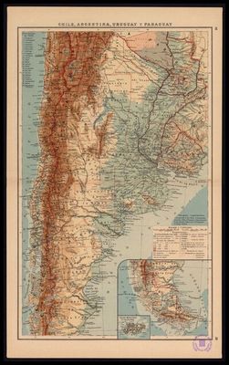
Chile, Argentina, Uruguay and Paraguay
Artista: Anónimo
Siglo XVII · Argentina
Colección: Museos digitales
Anonymous 17th-century map detailing the political and physical geography of Chile, Argentina, Uruguay, and Paraguay. It shows territorial divisions, cities, routes, and Andean orography, with a inset of the southern region.
argentina barro-de-oaxaca cartografia cera-de-abeja chile ciudad escala fronteras-nacionales